 |
メテオテック・ラボ台風予報 台風14号 |
|
メテオテック・ラボ台風予報 台風14号 |
| MDT | LAT. | LONG. | PRESS(hPa) | WIND SP. (m/s, kt) |
DIR. | SP. (km/h, kt) |
STORM W/N(km) | STRONG W/N(km) |
|---|---|---|---|---|---|---|---|---|
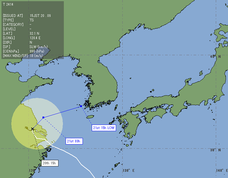
| 9/20 15JST | 32.1N | 120.4E | 998 | 18 / 35 | N | SLW / SLW | All - / | NE 390 / SW 220 |
| MDT | LAT. | LONG. | PRESS(hPa) | WIND SP.(m/s, kt) | STORM AREA(km) |
|---|---|---|---|---|---|
| 9/21 03JST | 33.3N | 121.6E | 998 | 18 / 35 | 0 | 9/21 15JST | 34.5N | 125.6E | 994 | 20 / 40 | 0 |
T-14 located around Shanghai and moves to northward slowly. From now on, it will re-curve and will change track to northeastward. Tomorrow, it will continue on a east-northeast track, and it will merge with the front around Korean Peninsula, and will become an extratropical in the evening.